Ampezzo – Oltris
Ancient routes
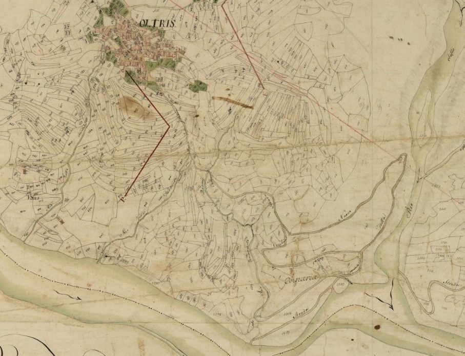
According to 1807 cartography, the climb from the Lumiei ford to Oltris followed two routes: one corresponds to the current road, while the other is a steeper path that has remained almost unchanged. The latter is still passable, though it is now deep in the woods rather than among the meadows of the past. On the opposite slope, however, the path to Ampezzo has disappeared, wiped out by the profound morphological changes caused by the construction of the modern road.
Urban evolution between land management and risk prevention
Oltris and Voltois formed a “double” municipality, which was originally independent of Ampezzo. Despite the relative distance between the two villages, they shared the same administration. Each hamlet had its own church, and the settlements were built on less fertile soil from a pedological standpoint—a deliberate choice to preserve arable land.
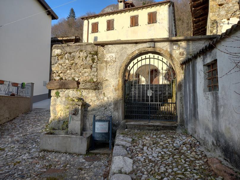
The residential core consisted mainly of traditional courtyard farmhouses, where the living quarters, stables, and barn faced onto an inner yard. The network of narrow alleys gradually expanded along the slope, with the construction of new buildings increasingly distant from the original center.
Even in these locations, the homes of the artisan middle class began to stand out due to the presence of porticos on the ground floor. However, until the end of the 18th century, roofs were still made with steep thatched slopes. This construction style made it difficult to limit the consumption of agricultural land, as buildings had to be kept spaced apart to prevent the spread of frequent fires.
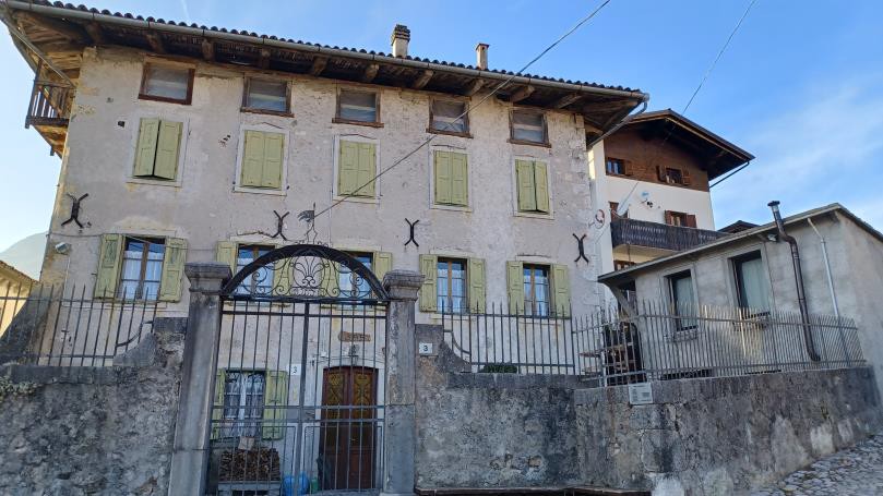
In Oltris, the Tadio house stood apart from the rest of the village. It was an eighteenth-century building that drew inspiration from Venetian villas or palaces rather than the typical urban house model.
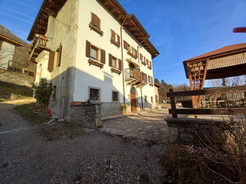
The traditional weavers’ houses featured porches and were only two stories high; the three-story elevations are instead the result of renovations that took place between the late 18th and 19th centuries.

This process of slow transformation in vernacular architecture continued until the end of the nineteenth century, in response to population growth and the formation of increasingly large family units.
The agricultural areas bordering the settlement were protected from human and animal intrusion by high fences, built by reusing stones cleared from the land.
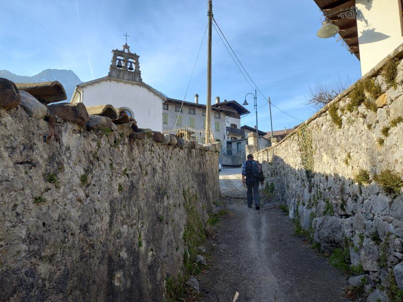
Within both public and private properties, common paths were marked by palisades or hedges woven with brushwood. Using wood instead of stone was a technical necessity: the most productive lands were loose and unstable. Building dry-stone walls could have caused hydrogeological instability by altering the natural flow of water.
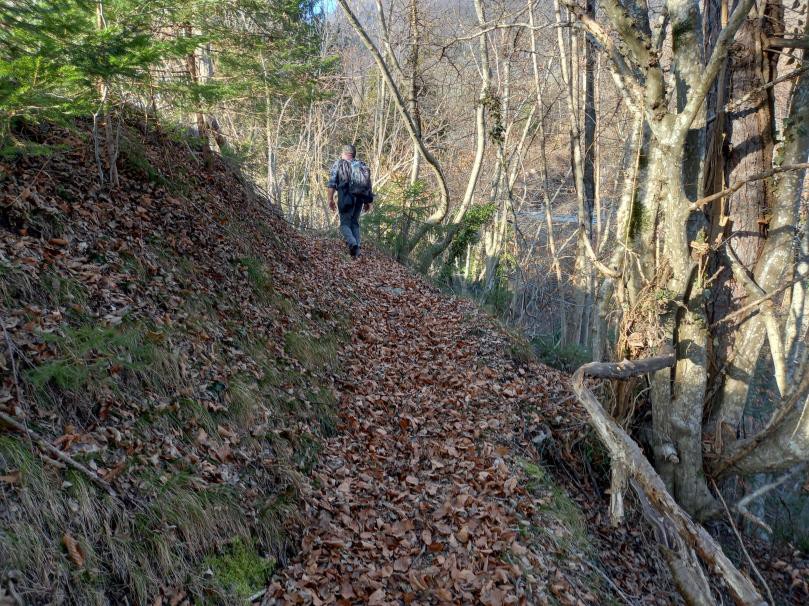
Once it reaches the edge of the natural terrace, the path—still clearly visible, though now lacking the wooden structures that once kept livestock from straying onto private land—drops steeply down the slope carved by the Lumiei stream until it reaches the site of the historic ford. In today’s landscape, no trace remains of the late 19th-century bridge, which was the only example of a covered bridge in Carnia. To reach Ampezzo on the other side, you now have to follow the paved road.
