Lungis – Viaso (Lower Path)
The historical road system between Lungis and Viaso
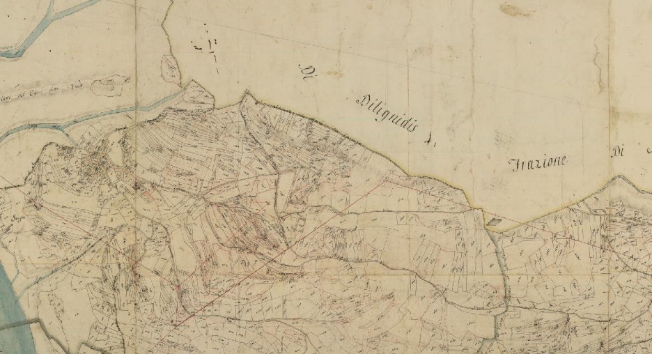
The 1812 cartography highlights how a network of paths connected Lungis to Viaso, crossing a dense mosaic of cultivated plots in an area that was extremely fertile at the time. Three main routes could be distinguished: the southern one, which wound through the less productive sectors of the moraine (characterized by eroded, washed-out land intended for pasture or woodland); the central one, which crossed the productive heart of the area with elongated arable lots adapted to the micro-morphology of the morainic deposit; and a third track, located even further south, which primarily served meadow areas.
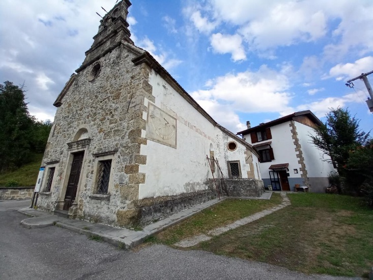
Lungis: architecture and settlement identity
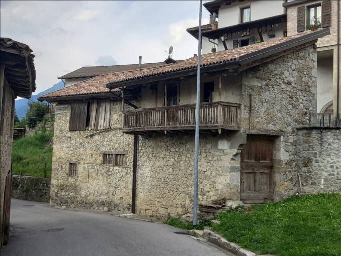
Lungis stands out for its architectural heritage of exceptional interest. In addition to the Church of San Giovanni Decollato, a precious example of a perfectly preserved settlement layout, the village boasts significant architectural examples: from the 17th-century weavers’ houses to 18th and 19th-century dwellings with wooden loggias, up to the taller, more compact buildings of the 19th century.
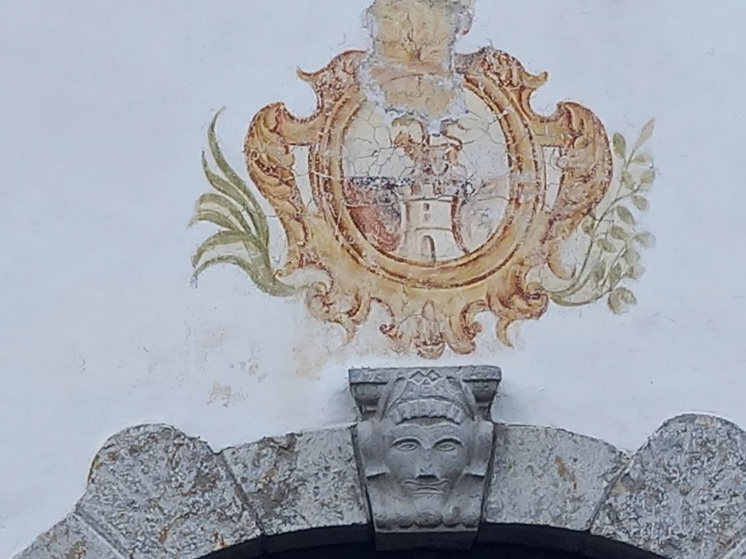
A prime example is Casa Bertoli: the portal and the coat of arms bear witness to the ambition of certain families to bring a bourgeois narrative even into a rural setting. The attention to detail and the understated elegance of the architecture reveal lifestyles far removed from mere agricultural subsistence, which were also shared by the Bernardis family. Facing the main road, the Bertoli palace adopts an almost urban language, with a masonry wall where solids prevail over voids, in sharp contrast to the transparency of the agricultural loggias. The internal layout is tripartite, with a central hall used for distributing the spaces. At the rear, the building takes advantage of the slope of the land with a semi-basement protected by a long portico, once used for artisanal work.
The preservation of traditions
In Lungis, the typical houses with wooden loggias have been better preserved than elsewhere, with at least five outstanding examples. These structures were characterized by a series of rooms accessible directly from the wide loggia, which also incorporated the staircase within it.
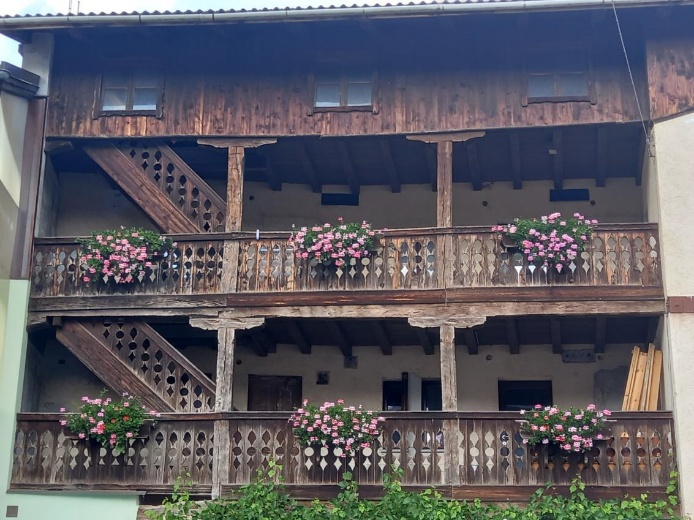
Originally, each household also had rural outbuildings, many of which have been converted into homes over the last few decades.
Transformations of the contemporary landscape
The path to Viaso branches off just below the village, running alongside one of the last still-active farms. The public road, now wide, descends toward areas that were once meadows. Although the surrounding environment is largely reforested, the route remains historically clear and intersects the path coming from Mediis.
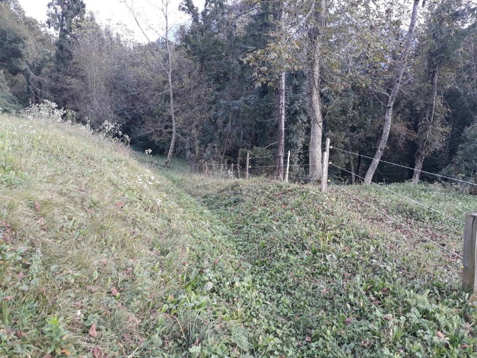
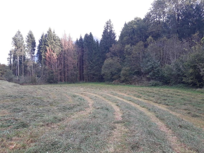
The ancient meadowland vocation is now visible only on the flat stretches, where the mechanization of haymaking is still possible. In contrast, the areas marked by the ruggedness of post-Würmian erosion have been overtaken by secondary-growth forests.
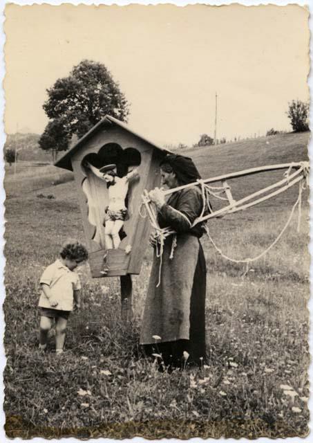
The ancient crucifix
Shortly before Viaso, the lower path merges back with the central one, which is now paved and serves as the main road connecting the hamlets. Following this route, near an ancient crucifix, you quickly reach the village of Viaso.
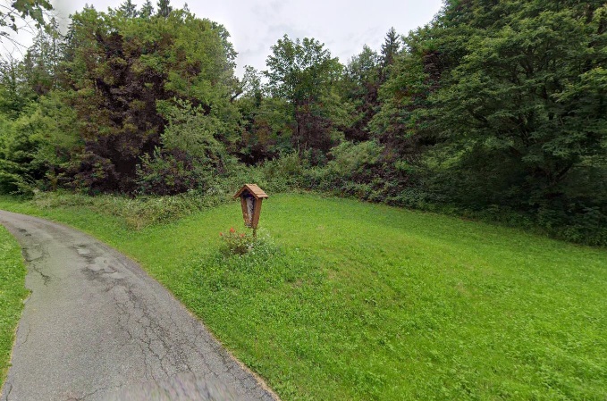
A vintage photograph shows the traditional small altar dedicated to Christ, located exactly on the border between the plowed fields and the pastures. That spot wasn’t just a religious landmark, but a true landscape and agricultural boundary. Today, with the decline of the haymaking economy, that limit has vanished: secondary plant succession and the forest are progressively encroaching upon and reclaiming the historic grasslands.