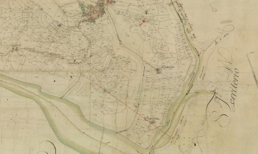
Voltois – Borgo Siega
The hamlet of Voltois stood on a steep and deeply furrowed slope, connected to the rest of the territory by only three main paths. The first descended toward the Lumiei stream, following the current road to Oltris and Ampezzo; the second headed upward toward Feltrone; the third, finally, wound eastward toward Borgo Siega di Lungis.
This last route, despite being the least structured, held strategic importance: it crossed a series of productive terraces characterized by clusters of stables with thatched roofs, such as in the localities of Taviella or Chiazzis. Continuing eastward, the path reached the two stable hamlets of Degrona, which were also immersed in a landscape of meadows and arable land. At the time, wooded areas were rare and limited to specific types of “wooded meadows,” used for hay or coppicing.
Today that landscape, once almost devoid of trees, is hardly recognizable: the fertile slopes below Voltois have in fact been reclaimed by a dense secondary-growth forest. After crossing the Rio Degrona (or Negrona), the path reached Borgo Siega, an ancient village of sawmills and mills belonging to Lungis.
Characteristics of the terrain and the trail
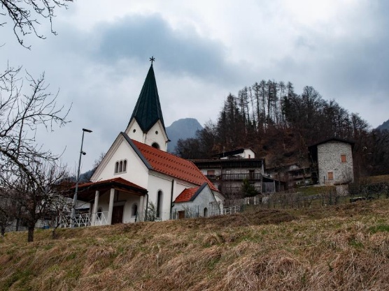
Despite its exposed position and the lack of fertile soil around the houses, the hamlet of Voltois overlooked an area that became productive as it descended into the valley, as evidenced by the traces still visible along the path today. The trail winds past the new church along a particularly steep section: here, the forest has always been managed as coppice to stabilize the slope and mitigate the risk of landslides.
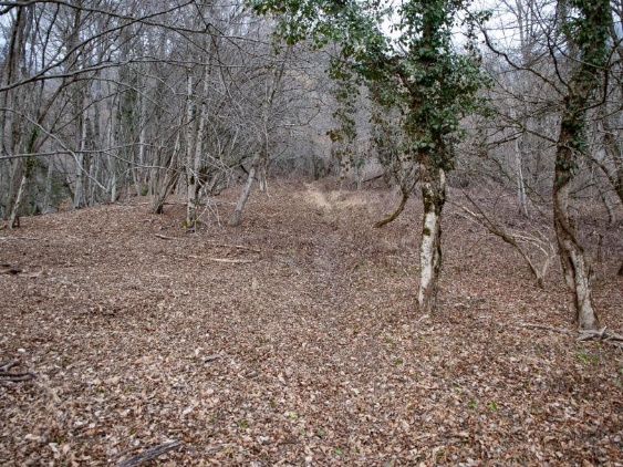
After a steep descent, the path crossed the most fertile and level grounds, dotted with small stables used to shelter livestock during the shoulder seasons. This is still discernible from the lack of rocky outcrops and the man-made contours of the land, even though many of these areas are now overgrown with brambles or dense vegetation.
Architecture and road networks
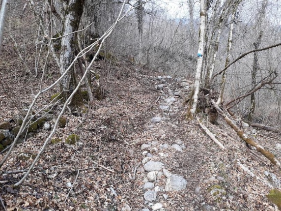
The route unfolds along a series of morainic terraces connected by steep climbs. The width of the roadbed confirms its historical significance: along with the road to Ampezzo, this mule track was one of the village’s main communication links with the outside world. In the section closest to the Lumiei, you can see the remains of ancient hornbeam plantings lining the road; once regularly pollarded, these trees now boast massive trunks. To protect the track’s foundation from rainwater erosion—which is particularly damaging to the area’s fine deposits—the walking surface was reinforced with a stone paving, made from rocks cleared from the neighboring fields.
Almost the entire route crossed through private, intensely cultivated land. Only in short sections are dry stone walls still visible, built to prevent passing livestock from invading the crops; otherwise, the boundaries were likely marked by wooden fences or woven hedges (“living wood”), of which no trace remains today.
